Our World in Motion
Oftentimes, a static view just doesn't convey the desired message. A powerful alternative is animation. With animations, you can "fly through" a proposed development, visualize landscape change or watch a process (e.g., sun movement, erosion model results or simulated flooding) in motion. Animations can play an important role in video production, illustrating concepts in ways unattainable through traditional methods.
On this page you'll find a few examples of diverse animation applications. We've successfully utilized computer animation and video production on a number of projects, including the award-winning "San Juan Skyway: Mapping the Road to Conservation Success."
If you would like to see samples of our animations and video projects, visit our animation projects portfolio!
Solar Incidence
An interesting group of applications involves the analysis and visualization of incident solar energy. Uses include solar panel siting and solar access issues arising from new construction.
This movie illustrates solar incidence through the daylight hours of an idealized December 21st (no cloud cover) and includes both shading and shadow casting. The final frame shows the relative solar incidence across the landscape, summed at one hour intervals for the entire year. Red and orange areas are "hot" (high relative solar incidence); blue areas are "cold" (low solar incidence.)
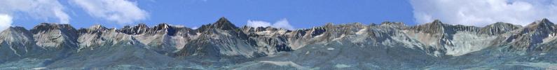
Fly-Throughs
Ever wish you could fly over the San Juan Mountains? Or through the Grand Canyon? Fly-throughs are perhaps the most common form of terrain-based animation. Their relative simplicity does not diminish their effectiveness as a visualization tool, however.
Fly-throughs are often used to orient a viewer to the physical features of a region. Also, "before" and "after" fly-bys of some landscape disturbance are helpful for decision makers evaluating development proposals.
High Impact Video
One of the strengths of CTM's animation services is using special effects to emphasize an issue or conflict. We've spent a great deal of effort developing software tools to morph terrain and objects, clarify abstract phenomena and focus attention on crucial issues.
This video uses a special algorithm to "turn on" patented mining claims as they come in to view. These mining claims are privately-held inholdings within an otherwise publicly-owned landscape. The effect of the animation is to focus the viewer on the magnitude of the problem. (From "Alpine Loop: Opportunity Knows No Boundaries" DVD)
Photo - Matching
Another interesting application is photo matching, where we match the viewing perspective of a
photograph with a computer model. This is commonly used in "photo simulation" where a landscape disturbance is rendered or "painted" into a photograph.
In this animation, an airplane - with some bizarre scanning capability - flies over and casts shadows onto (or into) a matched photograph.
Volume Modeling
The applications shown above deal with phenomena at or near the Earth's surface. Surface modeling is sometimes referred to as "2.5-d" (or 2.5-dimensional.) Volume modeling enters the world of true 3-d (or 4-d when time is also considered.) Volume modeling is required in many subsurface and atmospheric applications.
Visualization becomes more challenging in this environment. Isosurfaces and "slicing and dicing" a volume are two common techniques. An isosurface is the 3-d space equivalent of a contour line (or isoline) in 2-d space. An isosurface might show, for example, the (surface) area of a hurricane with category 5 wind speeds (156 mph, Saffir-Simpson Hurricane Scale.) Slicing a volume is useful for showing the range of values that occur along a particular cross-section.