We've been working for a number of years with the great folks at
Commonweal Conservancy on a conservation development project at the 13,500-acre
Galisteo Basin Preserve south of Sante Fe, NM. Commonweal's goal is to focus the development in a small portion of the property and preserve approximately 13,000 acres as open space. They've spent a lot of time, money and effort determining the best locations for development and they've made sustainability the driving consideration.
Here's an overview showing the property with a viewshed map overlaid.
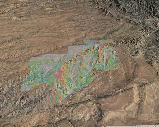
From a technical standpoint this has an interesting feature. We've defined a primitive in our 3d program for a "draped image-filled polygon." So rather than trying to build the transparent viewshed map into all the image tiles prior to rendering, it's a simple matter of specifying the image and clipping polygon - something really quick and easy.