With Spike Productions, we recently finished a video for Colorado State Parks focused on promoting partnering opportunities at the soon-to-be-opened Staunton State Park. Here's the entire video from the vimeo site:
State Parks - recently merged with the Division of Wildlife - is facing an incredibly challenging fiscal environment. Due to budget constraints, General Fund revenue is gone. They're relying on fees, grants and allocations from the the Colorado Lottery and GOCO (Great Outdoors Colorado). In this new financial landscape, they've got to partner with individuals and organizations to make things happen at the Park.
Staunton State Park is sure to be a very popular destination - it's only about 40 miles from Denver. It'll offer a wide spectrum of outdoor amenities: from hiking and riding trails to technical rock climbing to outstanding wildlife viewing opportunities. To find out how you can help, check out http://www.stauntonpark.com.
Monday, September 26. 2011
Staunton Partnering Video
Monday, September 12. 2011
Valley Haze, Part II
In this post, I introduced a hybrid attenuation model that combines contributions to attenuation from distance and elevation. For simplicity, if we "clear the air" at higher elevations, we can simulate the crisp high country views while adding valley haze that increases with distance from the viewer.
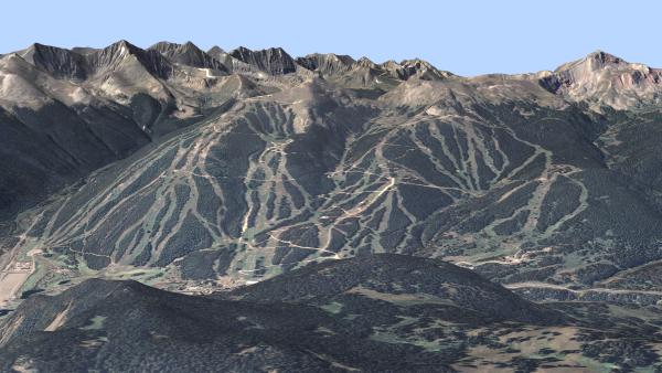
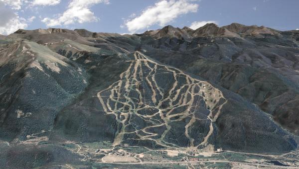
Here's another illustration. Here's a view of Copper Mountain with no attenuation. The skyline peaks show a beautiful crispness, but the middle of the image - around the ski area itself - is a bit ho-hum (click for high res image - ~13.3 Mbytes):
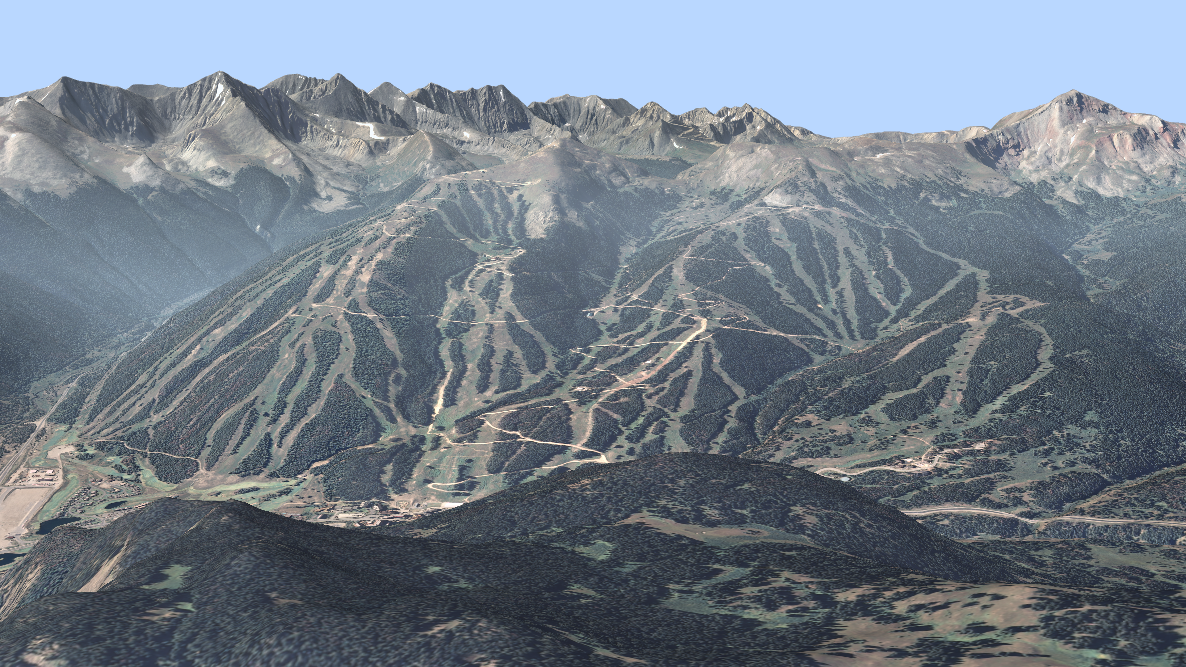
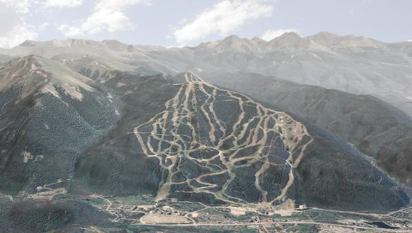
This next example includes the hybrid attenuation. The peaks retain most of their crispness while the valley attenuation increases the realism and enhances the 3d feel of the rest of the image (click for high res - ~12.7 Mbytes):

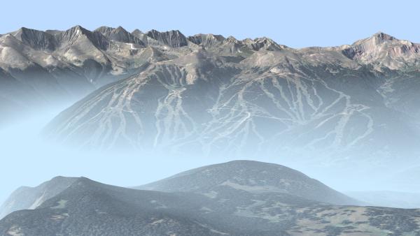
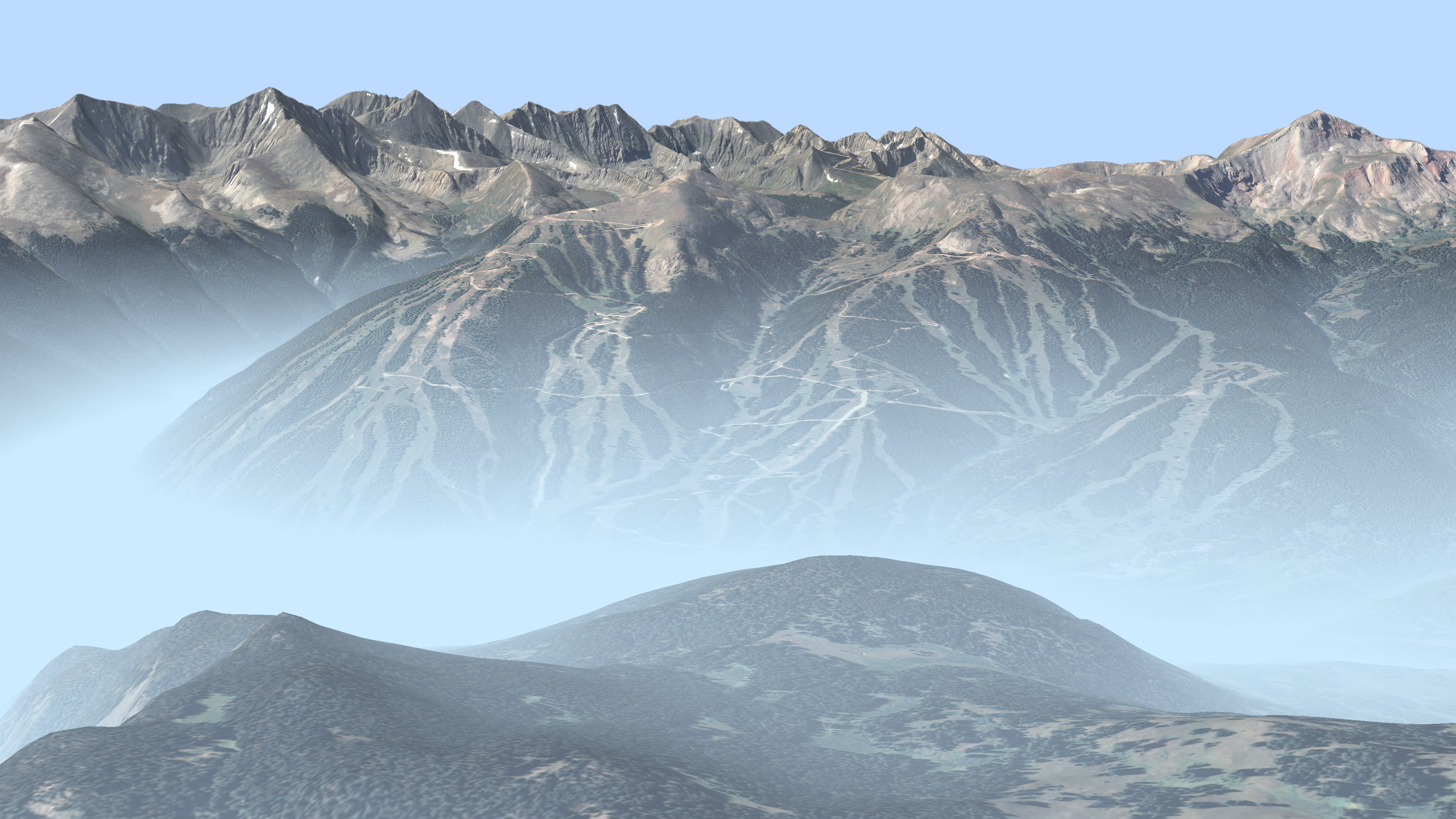
And if you really what to go wild, here's an example with the lower valleys completely obscured by haze (click for high res image - ~8.8 Mbytes):
Here's another illustration. Here's a view of Copper Mountain with no attenuation. The skyline peaks show a beautiful crispness, but the middle of the image - around the ski area itself - is a bit ho-hum (click for high res image - ~13.3 Mbytes):

This next example includes the hybrid attenuation. The peaks retain most of their crispness while the valley attenuation increases the realism and enhances the 3d feel of the rest of the image (click for high res - ~12.7 Mbytes):
And if you really what to go wild, here's an example with the lower valleys completely obscured by haze (click for high res image - ~8.8 Mbytes):
Friday, September 2. 2011
More Ridgeline Stuff
In this post, I discussed using attenuation to help highlight ridgelines, particularly those that run nearly parallel to the viewing direction. While this is generally an effective technique, there are occasions where you get some undesirable results.
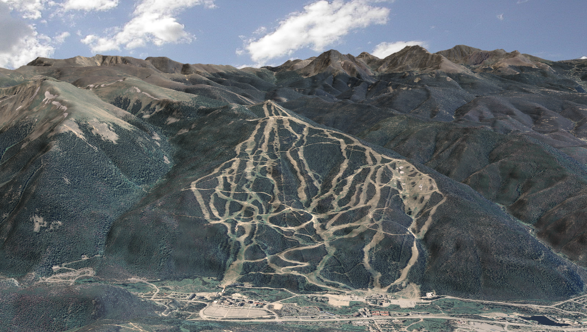
Take, for instance, this (no attenuation) image with Keystone ski area in the foreground and the Tenmile Range in the background (click for high res version).
I really like the crispness of the background mountains, but the ridgelines to the right (West) of the ski area don't "pop" as well as I'd like.
So, let's try distance-based attenuation (click for high res version):
There's better ridgeline definition, but the background peaks get washed out by the attenuation.
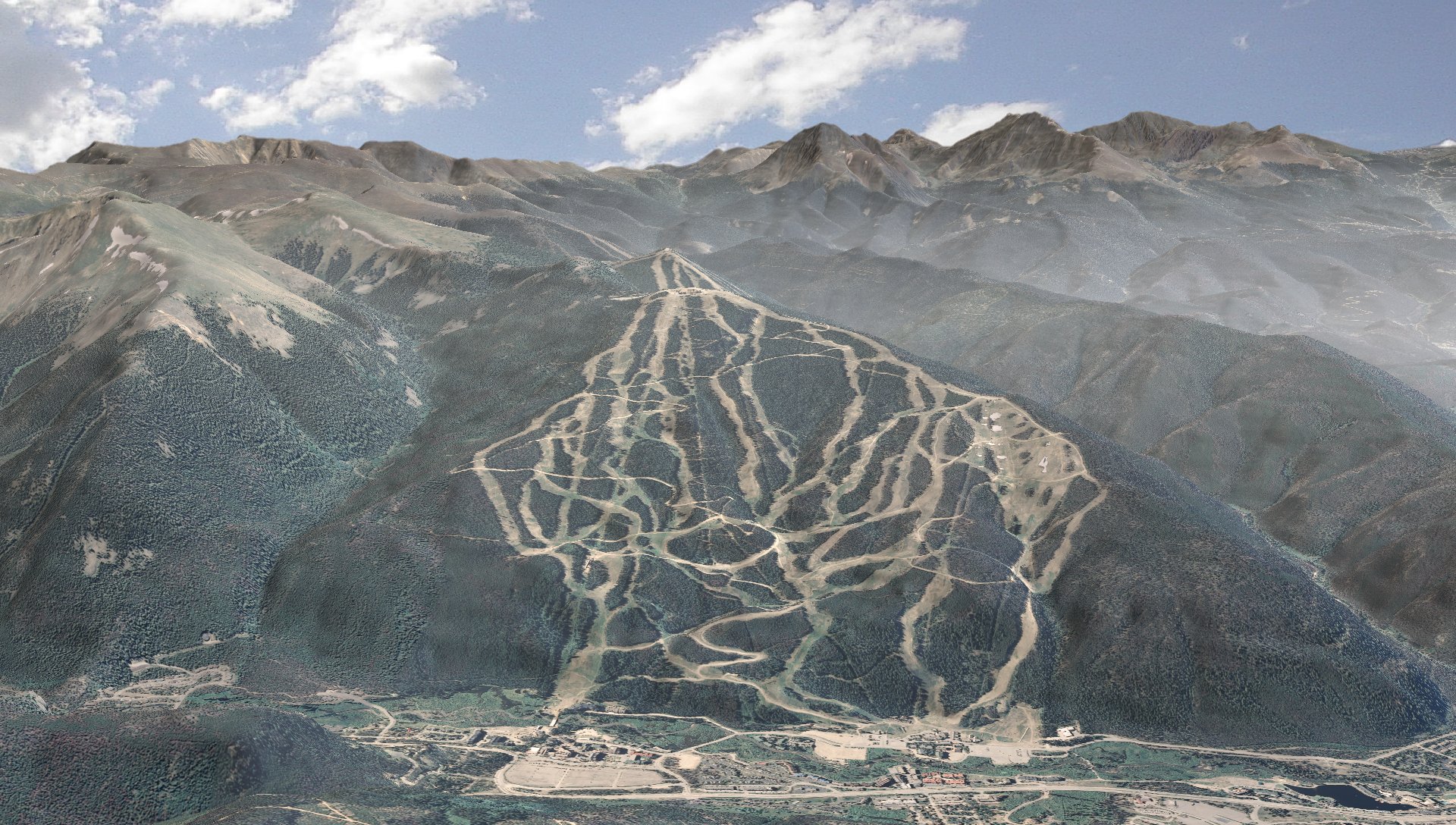
So, what if we "cleared the air" at higher elevations, still keeping the distance-based attenuation? I then got this result (click for high res version):

I still get good ridgeline definition, but much greater clarity in the high peaks!
Take, for instance, this (no attenuation) image with Keystone ski area in the foreground and the Tenmile Range in the background (click for high res version).
I really like the crispness of the background mountains, but the ridgelines to the right (West) of the ski area don't "pop" as well as I'd like.
So, let's try distance-based attenuation (click for high res version):

There's better ridgeline definition, but the background peaks get washed out by the attenuation.
So, what if we "cleared the air" at higher elevations, still keeping the distance-based attenuation? I then got this result (click for high res version):
I still get good ridgeline definition, but much greater clarity in the high peaks!


