Peakfinders show near ground views of an area's mountain backdrop with prominent landforms labeled. Peakfinders help residents and visitors learn about their geography and have been one of our most popular and requested products from customers. These can be generated from photographs, artist renditions or - in our case - computer renderings.
In the late 1980s, CTM produced our first peakfinder, which combined computer & artistic rendering -
View to the West. Since that time, we've created peakfinders for outdoor kiosks (see, for example,
this link) and a number of open space and trails maps (see, for example,
the Missoula map.)
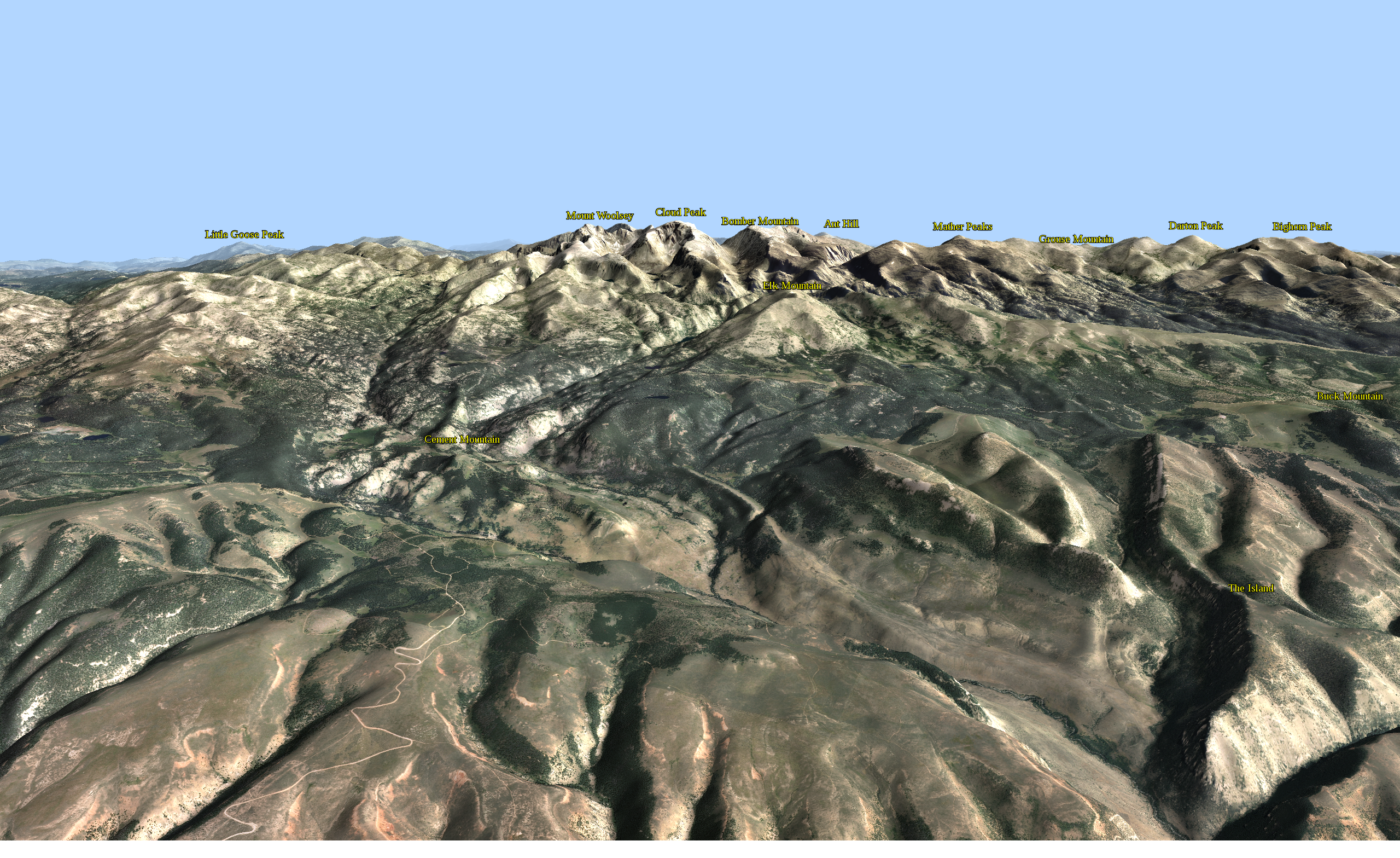
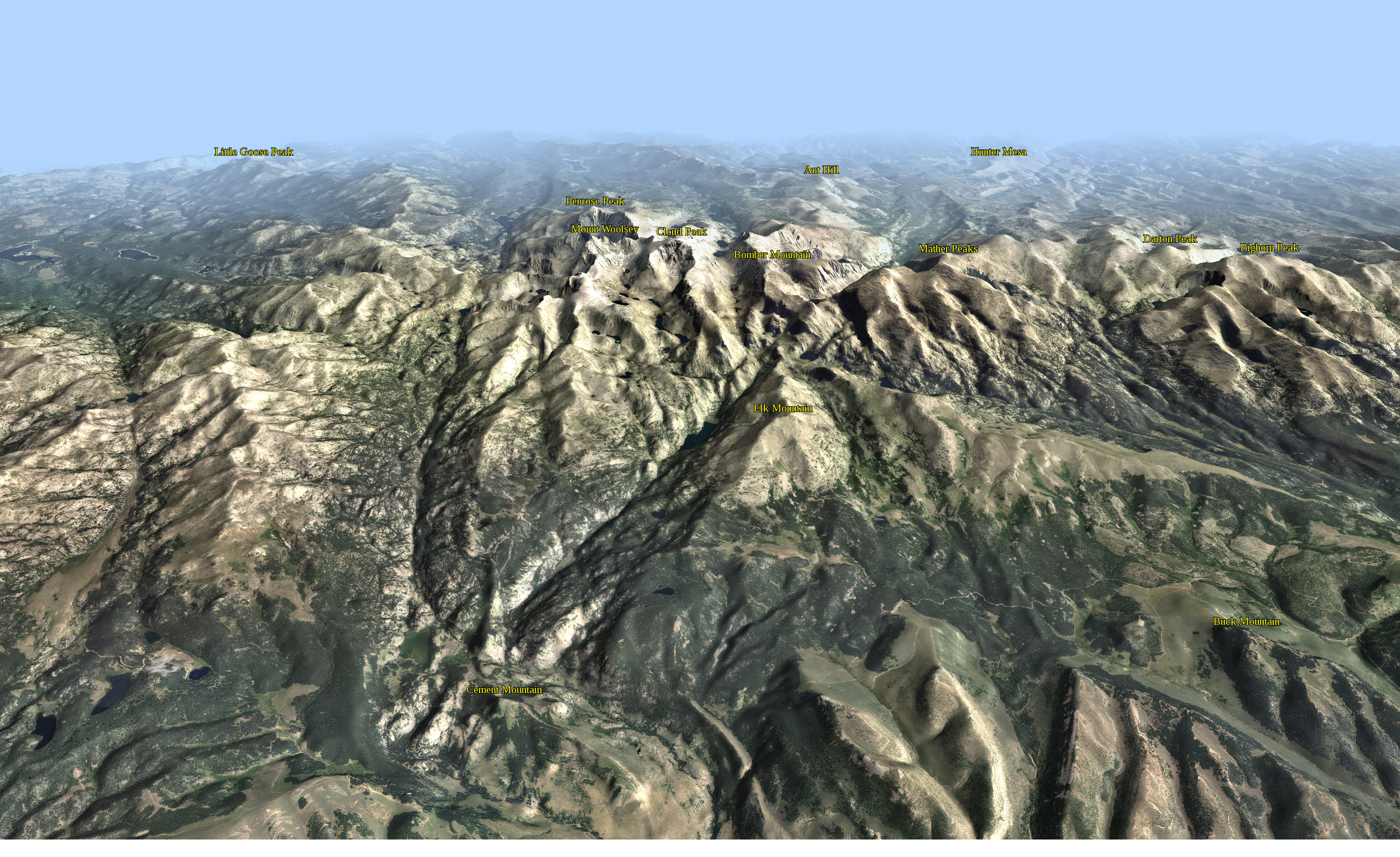
Here's one that I created of the skyline from the Silverton, Colorado, area:
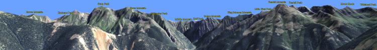
(Click image for higher res version.)
This was a partially successful attempt at automating the entire process. The computer rendering was created with edWare 3d. Summit text labels within the image area were taken from the USGS GNIS (Geographic Names Information System) dataset and projected into the image space, then automatically placed over the Silverton image using HTML5 and javascript. This second pass provides an opportunity to style text and other features utilizing the full HTML5 / CSS3 suite, rather than entirely through edWare 3d software. Shortcomings in styling are entirely my fault, not HTML5 /CSS3!