(Click image to get to image map site.)
Once on the image map site, mouseover a trail (you'll have to click (tap) on a mobile device) to get the trail name.
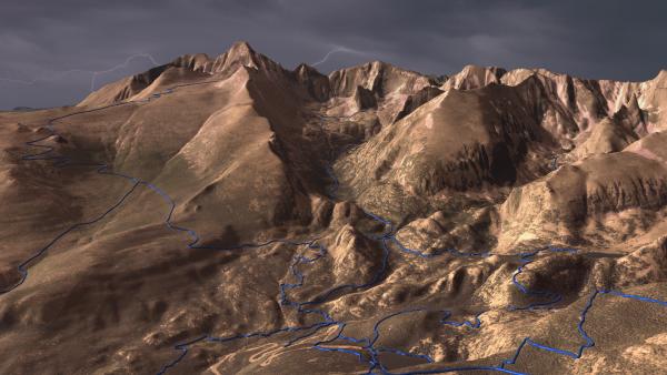
The background image was created with edWare 3d software, draping 1m res NAIP imagery over 10m res USGS DEMs. I used an ominous lightning-filled sky to add drama to the scene. The trails were extruded in the "tube" motif (there's a brief explanation here.)
For the trails, I downloaded a shape file from the Park Service site and projected the trails into "pixel space." Once in pixel units, I created vector buffers around the projected trails and defined area polygons in the image map. A javascript function invokes a server-side script to read the record from the DB and produce the text.
Longs Peak (14,256) is the major landform that bounds Glacier Gorge on the SE. This entire area is a specular destination for climbing - both summer and winter.


