We work in a lot of areas with substantial topographic relief. Topography is often the most compelling characteristic of an area and I've found a nice way to emphasize this fact. Instead of looking at a "flat" map or 3d view, what about transitioning between the two? Here's a clip from a video that we're currently working on for Colorado's Staunton State Park:
It's a slick way of focusing your attention on how mountainous the area really is.
Wednesday, February 2. 2011
Terrain Morph
Friday, January 21. 2011
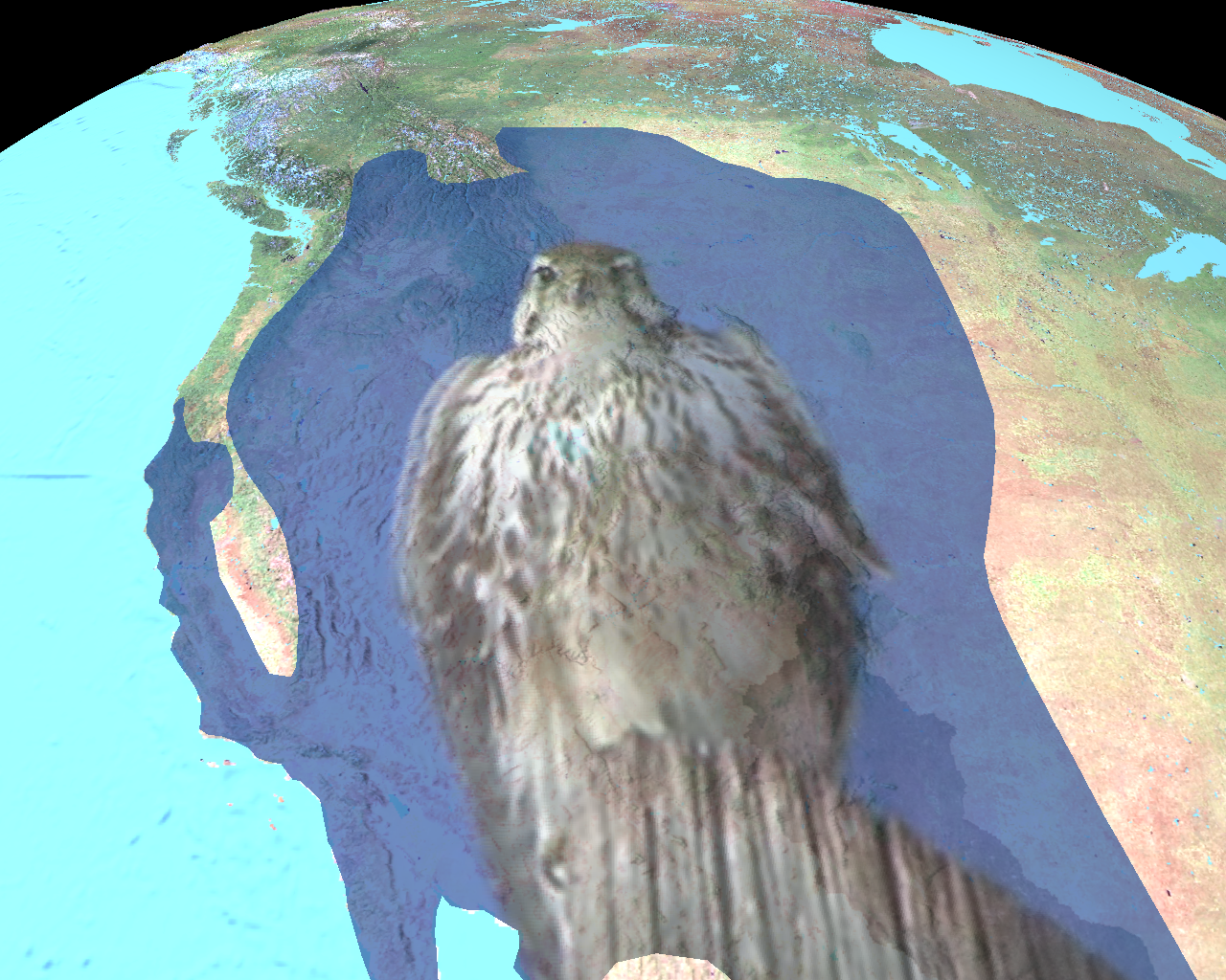
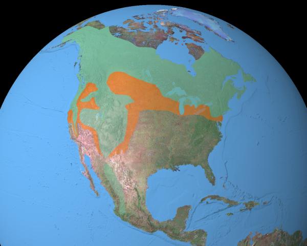
Prairie Falcon
Here's a visitor that we had a week or so ago - a female Prairie Falcon.
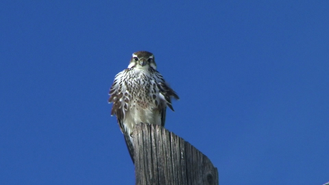
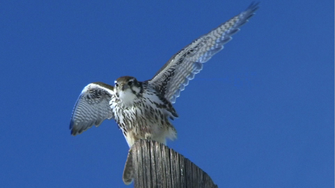
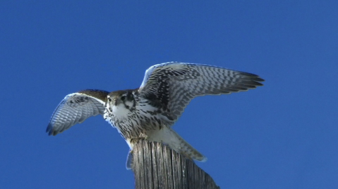
(All images courtesy of Cat Russell, Spike Productions.)
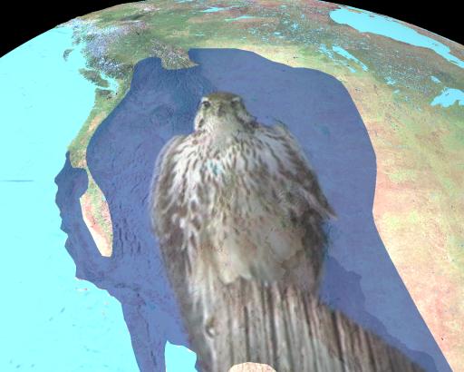
...and here's the Prairie Falcon range map (adapted from this site).
Like the Northern Goshawk, the Prairie Falcon predominantly hunts birds. It was was likely attracted by the large number of pigeons that we have hanging around.
(All images courtesy of Cat Russell, Spike Productions.)
...and here's the Prairie Falcon range map (adapted from this site).
Like the Northern Goshawk, the Prairie Falcon predominantly hunts birds. It was was likely attracted by the large number of pigeons that we have hanging around.
Friday, December 10. 2010
The Many Faces of Image Texturing
Image textures add interest to graphic primitives. In this rendering, I've included image textured cone, cylinder, sphere, 3d face and "draped" polygon (click for the high res version):
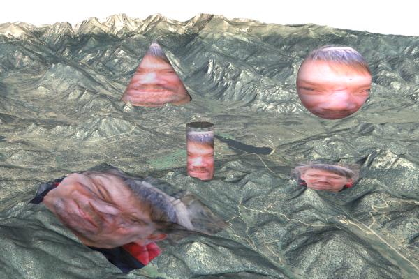
I'm particularly fond of the draped polygon!

I'm particularly fond of the draped polygon!
Tuesday, December 7. 2010
Thematic Data Visualization
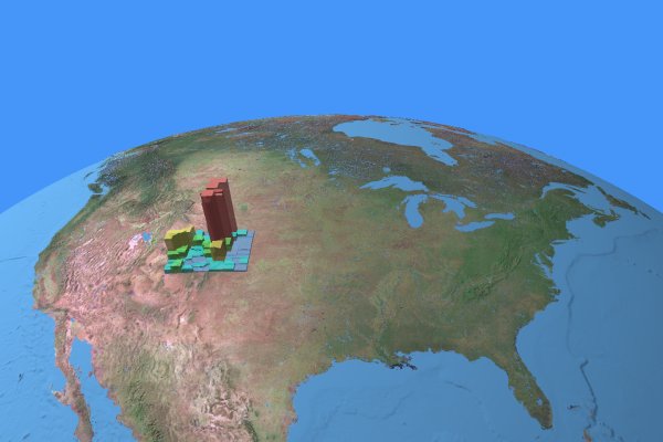
Here's an alternative to creating a raster "pseudo-elevation" data set of values for thematic data visualization: keep your polygons in vector and extrude based on the thematic value. This gives good color control - particularly on the sides of the extruded polygons - and lets you combine these with a real elevation data set (click for high res version):
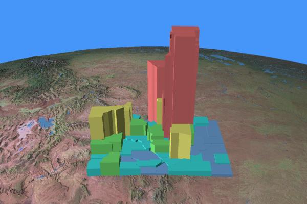
The image above illustrates absolute population growth for Colorado counties between 1990 and 2000.
An additional advantage of this technique: you can make your polygons transparent (click for high res version):
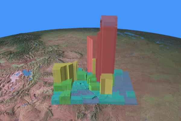
...and you can easily change views without adding more thematic data:

The image above illustrates absolute population growth for Colorado counties between 1990 and 2000.
An additional advantage of this technique: you can make your polygons transparent (click for high res version):

...and you can easily change views without adding more thematic data:

Wednesday, December 1. 2010
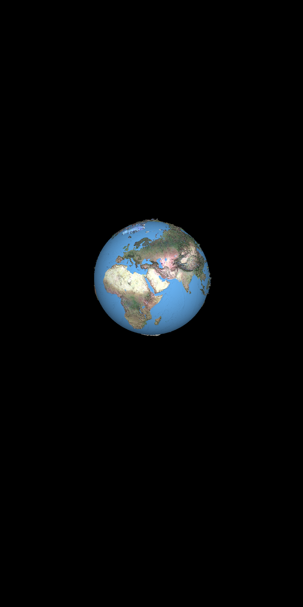
Why the Earth is round
Here's why spheres are better than cylinders when it comes to planets: it's that stupid tan 90 degrees stuff. See for yourself:

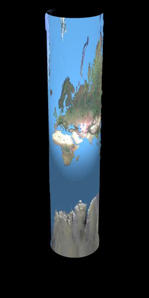
That's why Mercator uses that ln[tan[pi/4 + phi/2]) factor - and it still stretches the crap out of the high latitudes (and can't make it all the way to the poles)!

That's why Mercator uses that ln[tan[pi/4 + phi/2]) factor - and it still stretches the crap out of the high latitudes (and can't make it all the way to the poles)!
Tuesday, November 23. 2010
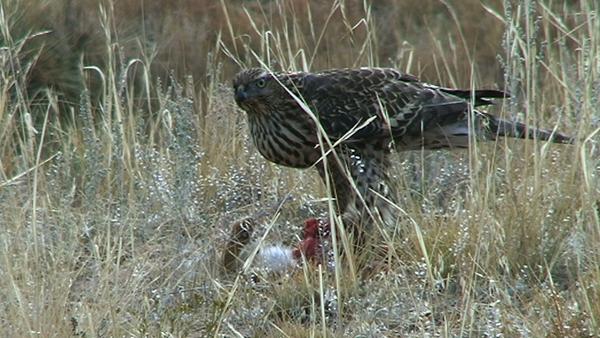
Northern Goshawk
A couple of weeks ago we had an unusual visitor - a Northern Goshawk. The Northern Goshawk is the largest North American raptor in the Accipiter genus. Accipiters usually hunt other birds, but this one - a female - killed a rabbit near our house. Here's a picture (courtesy of Cat Russell from Spike Productions):
Looking at their range, it becomes clear where the "Northern" part of the name comes from. The map below is adapted from one I found on a US Fish and Wildlife site.
We typically see the Accipiters during Fall and Spring, when they're migrating.

Looking at their range, it becomes clear where the "Northern" part of the name comes from. The map below is adapted from one I found on a US Fish and Wildlife site.

We typically see the Accipiters during Fall and Spring, when they're migrating.
Friday, November 19. 2010
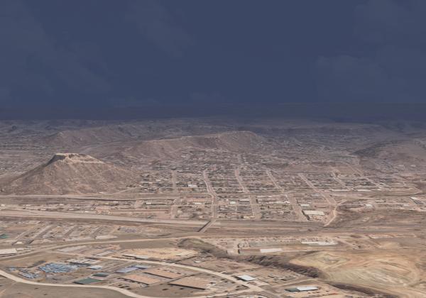
Impending Storm ... or Clearing Skies?
I've been messing around with lighting and attenuation as a simple way to provide the feel of different weather conditions.
Here's the impending storm (click on image for larger version):
and the clearing skies (again, click for high res version):
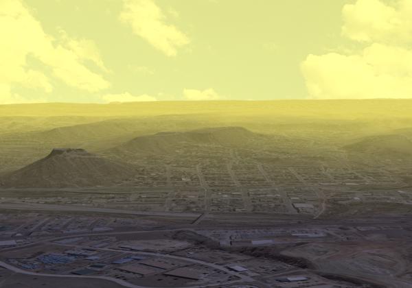
Same view, imagery, etc - just different lighting and attenuation.
Here's the impending storm (click on image for larger version):
and the clearing skies (again, click for high res version):
Same view, imagery, etc - just different lighting and attenuation.
Monday, November 8. 2010
Making Linework "Pop"
Ever had problems making lines readable across different background colors? Here's an interesting technique (click on the image to see the whole picture):
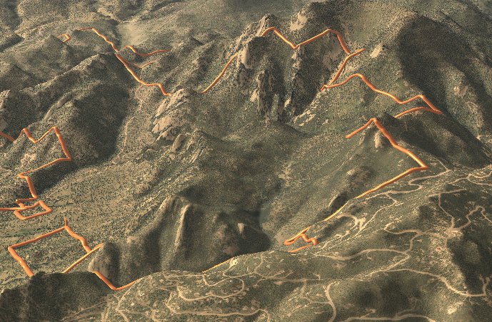
The image above shows a property boundary; the one below shows a social trail network.
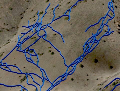
We've "extruded" a circular cross-section along each trail path to create a thin "tube." This tube is a 3d object that is subject to the lighting model and can be assigned a variety of reflective characteristics. It has the additional advantage of diminishing in size with distance, so it provides depth cueing into the scene. We started using this some years back to overcome difficulties with drawing simple 2d lines over varying background colors.

The image above shows a property boundary; the one below shows a social trail network.
We've "extruded" a circular cross-section along each trail path to create a thin "tube." This tube is a 3d object that is subject to the lighting model and can be assigned a variety of reflective characteristics. It has the additional advantage of diminishing in size with distance, so it provides depth cueing into the scene. We started using this some years back to overcome difficulties with drawing simple 2d lines over varying background colors.
Wednesday, November 3. 2010
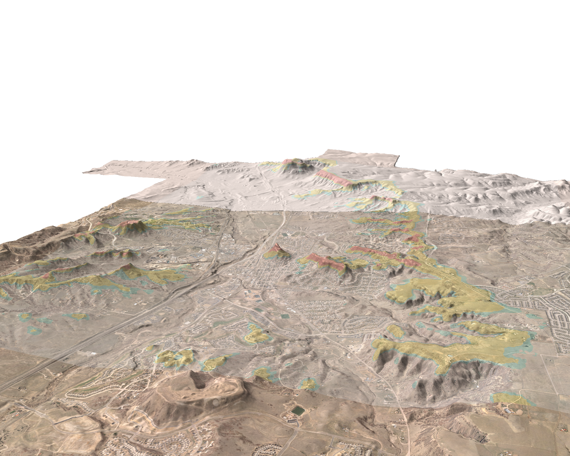
Castle Rock Skylines
We were involved in a ridgeline protection project back in 1998 for the Town of Castle Rock, Colorado. This project was an early application of our skyline mapping algorithm, which delineates areas of the landscape where structures would break the skyline. Here's a link to the ordinance that was approved at the end of the project; and here's the final map with legend.
The image below shows a birds eye view of the skyline map.
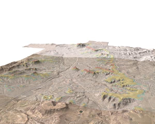
We've gotten a chance to revisit this work with a new project in the area. It's been very rewarding to find that - with the new tools available 12 years later - that the original mapping is holding up very well. I may be biased, but I think the Town has one of the most defensible ridgeline protection zones around.
The image below shows a birds eye view of the skyline map.
We've gotten a chance to revisit this work with a new project in the area. It's been very rewarding to find that - with the new tools available 12 years later - that the original mapping is holding up very well. I may be biased, but I think the Town has one of the most defensible ridgeline protection zones around.
Wednesday, October 6. 2010
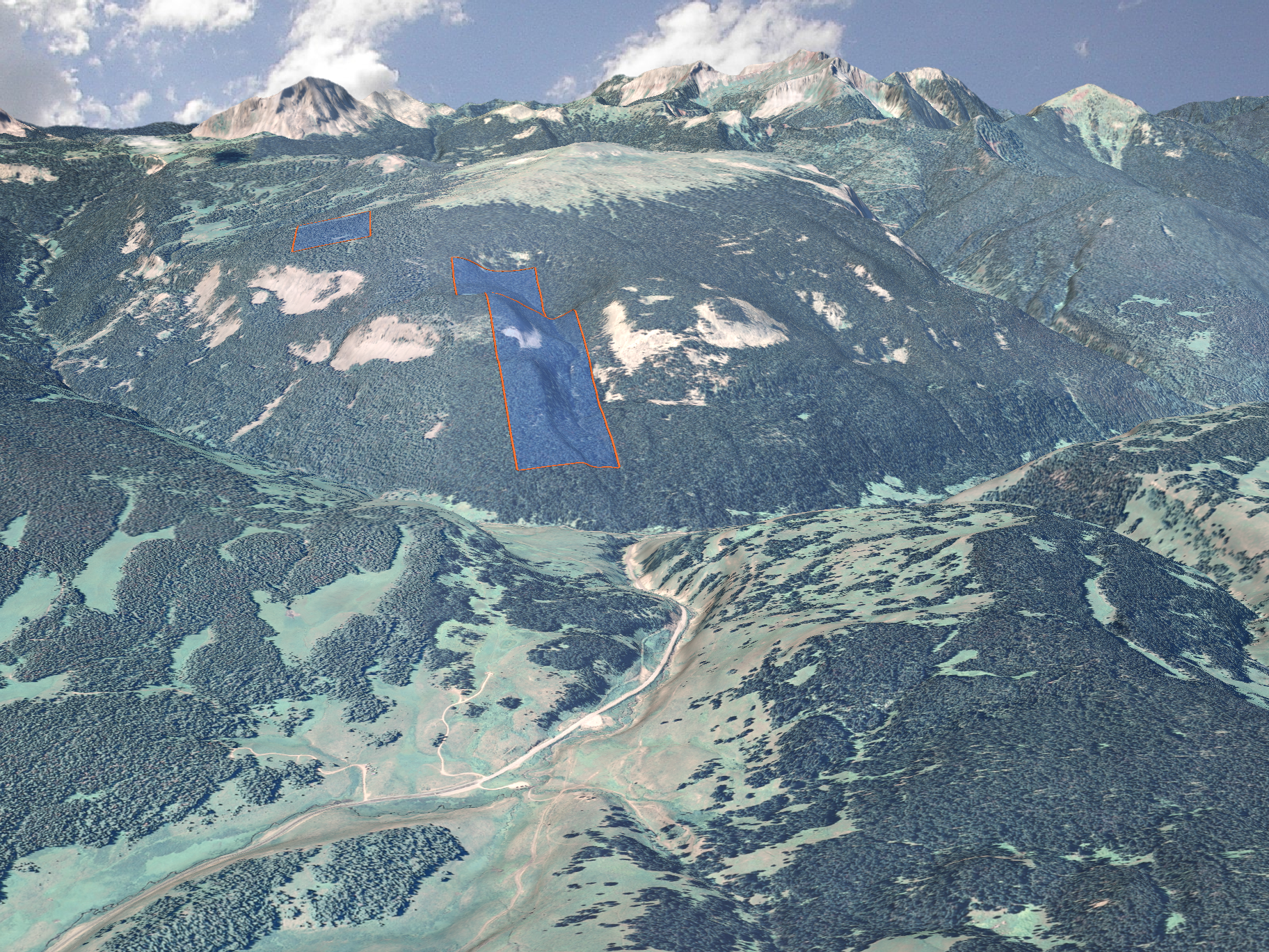
Conserving Land Along the San Juan Skyway
We've done a lot of work in beautiful SW Colorado (for Alpine Loop examples see here, here, here and here).
The area has drop-dead gorgeous scenery, fascinating American Indian and mining history and unbeatable outdoor recreation. Perhaps the greatest jewel in the region is the All-American San Juan Skyway - a scenic and historic byway that traverses an incredible landscape from desert to high mountains.
The Trust For Public Land is a great organization that we've worked with on projects across the western US and they've been working in the Skyway region for many years. They were pivotal in the tremendously successful Red Mountain project and here's one they're working on now, just south of Lizard Head Pass:

With a little luck, these high mountain properties will soon be publicly accessible US Forest Service lands! Congrats to TPL on this and many other successes in the San Juan Skyway area.
The area has drop-dead gorgeous scenery, fascinating American Indian and mining history and unbeatable outdoor recreation. Perhaps the greatest jewel in the region is the All-American San Juan Skyway - a scenic and historic byway that traverses an incredible landscape from desert to high mountains.
The Trust For Public Land is a great organization that we've worked with on projects across the western US and they've been working in the Skyway region for many years. They were pivotal in the tremendously successful Red Mountain project and here's one they're working on now, just south of Lizard Head Pass:
With a little luck, these high mountain properties will soon be publicly accessible US Forest Service lands! Congrats to TPL on this and many other successes in the San Juan Skyway area.
Thursday, September 30. 2010
Fun With LiDAR
I stumbled upon this image I created a couple of years ago from some LiDAR data. I was generating a DEM from the LiDAR points - and I guess I was bored. Instead of generating a "point cloud" image, I made a "sphere cloud" image where each (xyz) triple was a sphere center (I don't remember what I used as a radius.) Click on the image below to get the high res version.
It looks like I also did some elevation-based color scheme: blue hues down low with red increasing with altitude. Gives it a cold feeling in the foreground valley and an alpenglow feel in the back. I think the weird color pattern is due to point density.

It looks like I also did some elevation-based color scheme: blue hues down low with red increasing with altitude. Gives it a cold feeling in the foreground valley and an alpenglow feel in the back. I think the weird color pattern is due to point density.
Wednesday, September 29. 2010
Geo-Animation
Thursday, September 23. 2010
Galisteo Basin Preserve
We've been working for a number of years with the great folks at Commonweal Conservancy on a conservation development project at the 13,500-acre Galisteo Basin Preserve south of Sante Fe, NM. Commonweal's goal is to focus the development in a small portion of the property and preserve approximately 13,000 acres as open space. They've spent a lot of time, money and effort determining the best locations for development and they've made sustainability the driving consideration.
Here's an overview showing the property with a viewshed map overlaid.
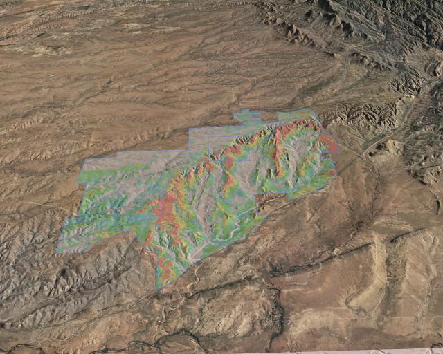
From a technical standpoint this has an interesting feature. We've defined a primitive in our 3d program for a "draped image-filled polygon." So rather than trying to build the transparent viewshed map into all the image tiles prior to rendering, it's a simple matter of specifying the image and clipping polygon - something really quick and easy.
Monday, September 20. 2010
Blue Sky Trail
Friday, September 3. 2010
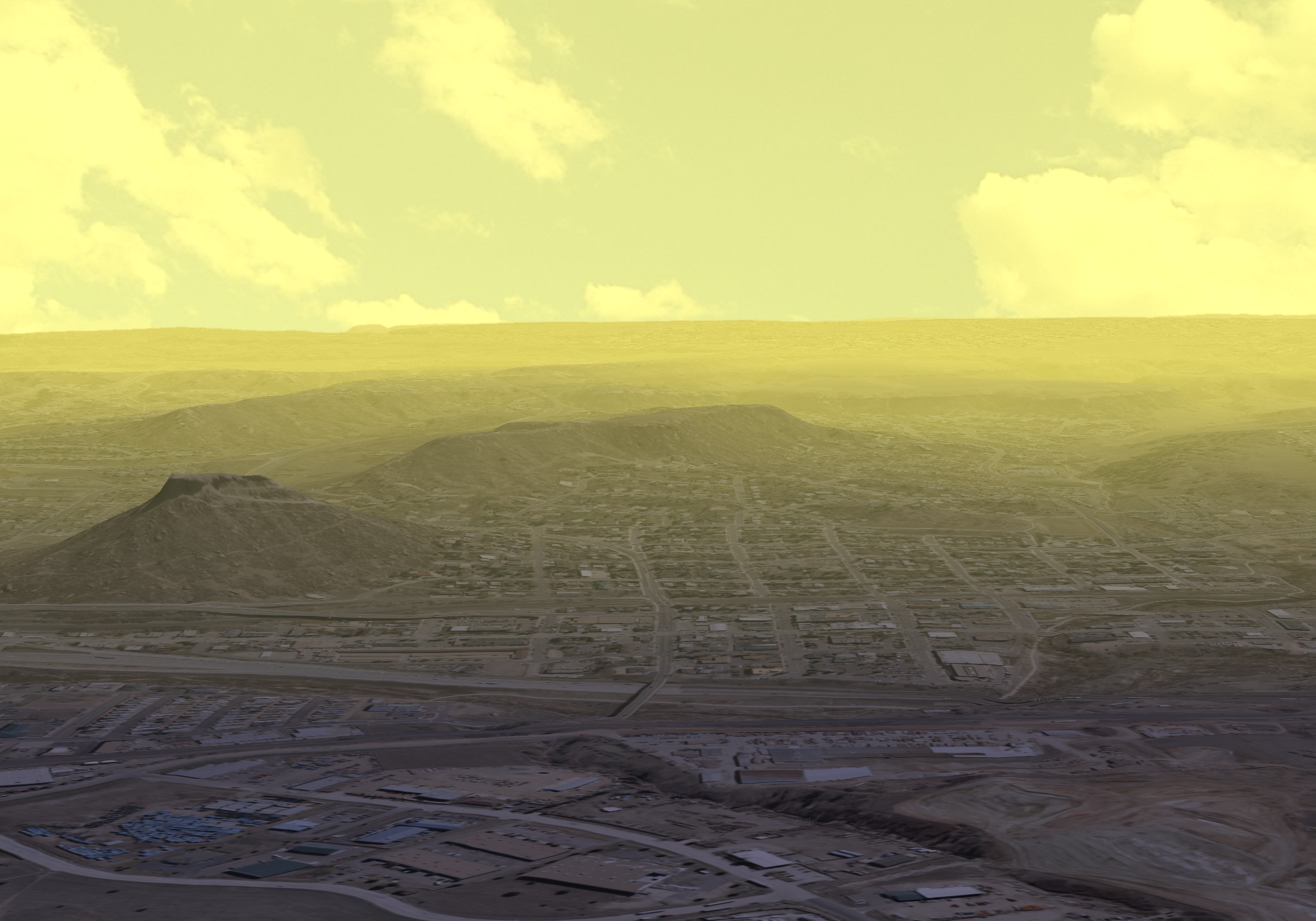
Defining Ridgelines with Attenuation
We often use 3d visualization to highlight specific landforms like ridgelines. When you view along the ridge axis, you can use lighting that's roughly perpendicular to the ridge axis to highlight. In this way, one side of the ridge is illuminated while the other is shaded.
It's more difficult to bring out a ridge when you're viewing a face straight on (perpendicular to the ridge axis). The whole face is usually either illuminated or shaded and it's hard to distinguish it from background landscape elements.
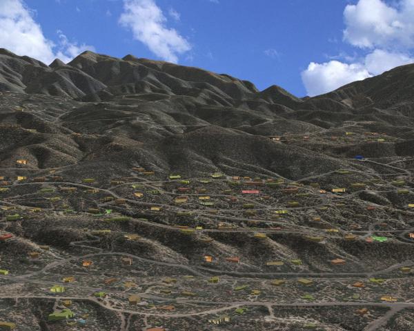
In the image above, I'd like to highlight the ridge in the center. Right now it blends in with the background terrain and is difficult to see.
Here's where attenuation comes in. I'll model clear air in front of the ridge and haze behind. Here's the result:
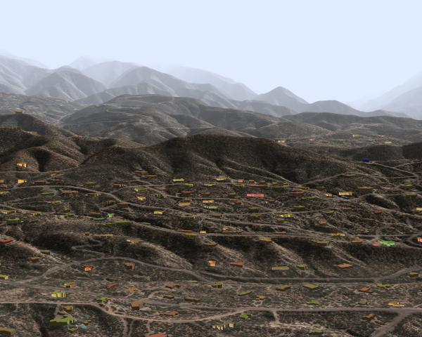
Now it really pops!


