
Wednesday, October 27. 2010
Missoula, MT Trail map nearing completion
We've been working with Missoula, MT to create a parks and recreation map for the Town. After several rounds of edits, we're almost there. Though there are lots of fun features on the map, my favorite is their mountain backdrop peak finder. The aerial photo clearly shows off their "Letter Mountains", the M on Mount Sentinel (towering over the University of Montana) and the L located on Mount Jumbo. The "peace sign" is just out of view on Water Works Hill.
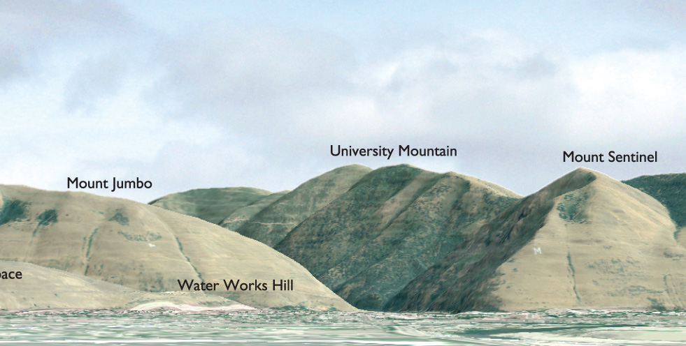


Peakfinders show near ground views of an area's mountain backdrop with prominent landforms labeled. Peakfinders help residents and visitors learn about their geography and have been one of our most popular and requested products from customers. These can
Tracked: Oct 17, 07:56