
Site Scale: Attention to Detail
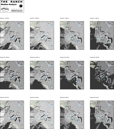 Shadow impacts from buildings and terrain.
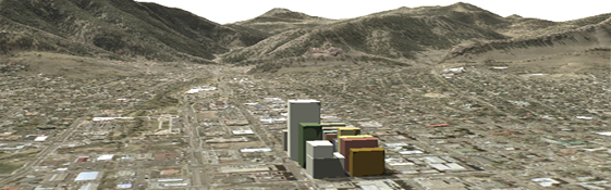
When siting development, infrastructure - even solar panels - it's important to optimize a property's positive features while minimizing off-site impacts. Determining resource conflicts early in the game - conflicts such as steep slopes, view corridors or natural hazards - improves the overall site plan and helps streamline the approval process.
We offer a variety of site planning tools, such as solar window calculations (including shadowing effects from topography and buildings), visibility census to minimize visual impacts of development, and detailed elevation model creation from surveyed contours. In addition, we can provide visual simulations of site construction or 3-dimensional renderings of a property. Our GIS technology offers a cost effective toolkit to help successfully plan your site.
If you would like to see samples of our site analysis projects, visit our site analysis projects portfolio!