 The Zia Landform CD-rom The Zia Landform CD-rom
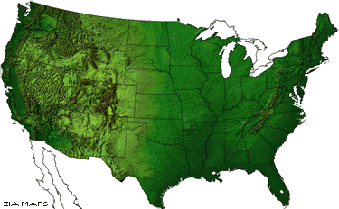
Zia's Landform Images CD-rom v1.0 is a set of raster and vector graphic data
files that are fully editable for use in desktop publishing.
These base maps were created to be used by designers in Graphic Arts, Cartography,
Geographic Information Systems (GIS), and World Wide Web.
Think of Zia Landform Images (ZLI) as advanced cartographic clip art, it is
not a software
package. You will need graphics software such as Macromedia FreeHand®, Adobe
Illustrator®, or
CorelDraw® to use and manipulate the vector data. You can view and/or manipulate
the raster
images with software such as Adobe Photoshop® or Corel Photopaint® or
ArcView®.
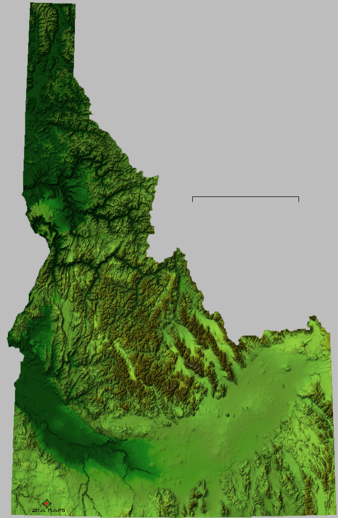
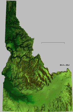 Idaho high resolution image ID.gif
Zia Landform Image features include......
1. Raster Base Maps in Tiff and GIF formats.
CD-rom version contains high resolution, shaded relief color elevation
tinted base images each overlaid with text and line features
providing a comprehensive set of cartographic imagery for a wide
variety of uses. All 50 individual United States, the continental USA
and 10 sub-regions are on this disk.
These raster images serve as accurate base maps for graphic or
cartographic productions. Any software that allows importing,
opening or "placing" of TIFF or GIF(24 bit and 8 bit color
respectively) raster image can be used to view these images.
Each image is geo-referenced and can be imported by GIS or
cartographic software, such as ArcView or MapInfo, where
additional features can be added. A text file at the end of the State
and Regional directories provide location parameters.
2. Vector boundaries and points.
A selection of line work and point locations are provide on each
image. They include; major drainage's, lakes and reservoirs,
city/town locations, state line and highest point in state.
Line and point features are located accurately on the raster base map
images. Features are also grouped by category.
3. Features Names
There are names for all point and line features listed above and of
selected physical features. Names are grouped by category.
4. County lines and names.
County lines and names for all 50 states are in a stand alone
directory. High resolution county lines are best fit to the state line
derived from the state raster image.
Source data and processing;
USGS digital elevation models, 30 arc second, were merged, filtered
and imaged by CTM of Boulder, CO, using EdWare. Projected in
Albers with each image having its own central meridian. All images
have been cartographically altered correcting original data errors,
especially in the coastal regions. USGS DLG (digital line graph) data
was merged, layered and cross reference for text and line placement.
Final composition was with Macromedia FreeHand v5.0 and
exported to FreeHand v3.1, Adobe Illustrator v5.0 and v1.1. All
line and text is grouped by category. Raster image pixel count was
selected by balancing the needs of good color printing resolution of
133 lpi for a 1/3 to 1/2 page size and opened file size of 2 to 3
megabytes.
There
are limited Terms and Conditions for use of Zia Landform Imagery.
Back to Main page
Zia Maps Ordering Information