An effect that I'm particularly fond of for emphasizing terrain steepness is the "terrain morph." The idea is to transition from a flat surface into the 3D topographic view through a smooth series of steps as in this post.
Here's a nice example showing Longs Peak, Colorado.
Click through to the high def version to get the full experience.
I really like the "old school / new school" metaphor as well. The initial flat quad map has been around forever, but has now given way to interactive 3D views with textured high resolution imagery.
Tuesday, April 23. 2013
Another Terrain Morph
Monday, April 22. 2013
Slumgullion Slide and Lake San Cristobal
I've previously posted on the beautiful Alpine Loop Back Country Byway. Traveling southwest out of Lake City, you pass picturesque Lake San Cristobal - Colorado's 2nd largest natural lake. Here's an edWare3D rendering looking NNW along the Lake Fork of the Gunnison River showing the lake.
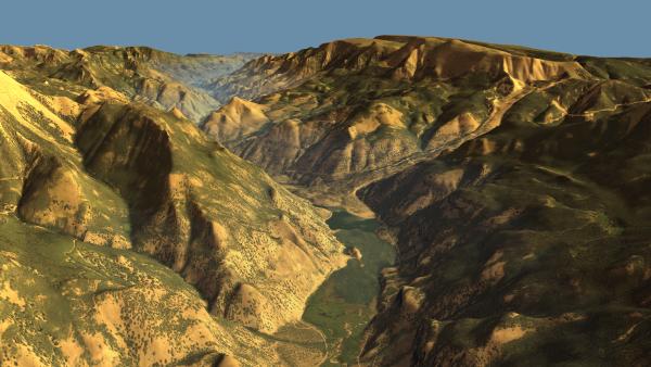
(Click for high res version.)
It also wonderfully illustrates the reason the lake's there - the Slumgullion Slide dammed the river. Here's a great resource for those interested in learning more about the slide. The landslide episode that created the dam occurred about 700 years ago.
A section of the slide is still active. Here's another rendering showing the active portion in red, with the inactive portions in blue.
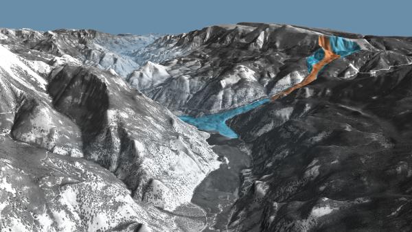
(Click for high res version.)
And here's an animation showing patented mining claims in the Alpine Loop area:

(Click for high res version.)
It also wonderfully illustrates the reason the lake's there - the Slumgullion Slide dammed the river. Here's a great resource for those interested in learning more about the slide. The landslide episode that created the dam occurred about 700 years ago.
A section of the slide is still active. Here's another rendering showing the active portion in red, with the inactive portions in blue.

(Click for high res version.)
And here's an animation showing patented mining claims in the Alpine Loop area:


