Here's an example (click for high res version):
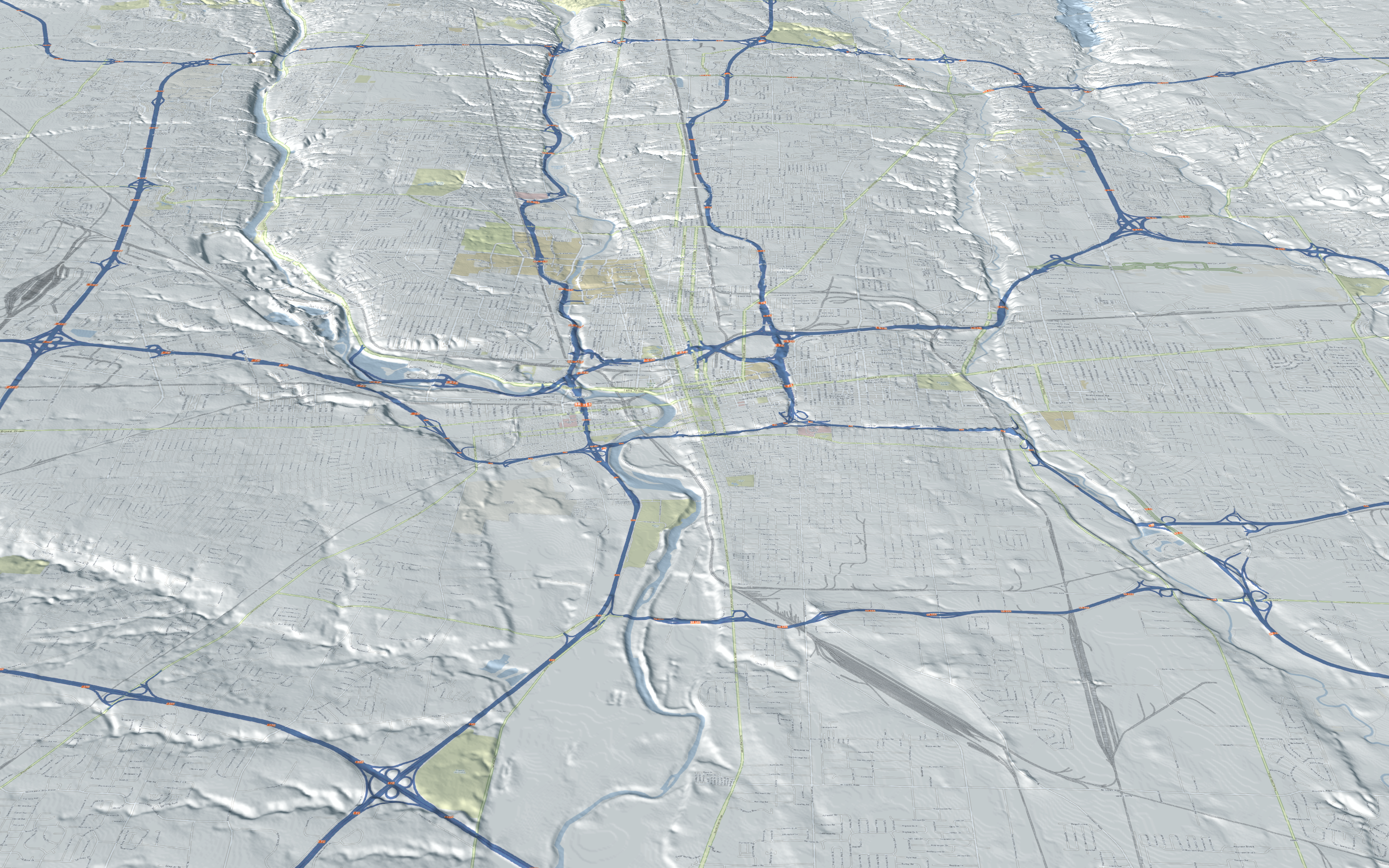
I generated tiles from a mapserver-based WMS that accessed the pgsql data. I'll need to play around a bit with scale to make the text readable in the 3d rendering.

|
April '24 |
|
||||
|---|---|---|---|---|---|---|
| Mo | Tu | We | Th | Fr | Sa | Su |
| Monday, April 29. 2024 | ||||||
| 1 | 2 | 3 | 4 | 5 | 6 | 7 |
| 8 | 9 | 10 | 11 | 12 | 13 | 14 |
| 15 | 16 | 17 | 18 | 19 | 20 | 21 |
| 22 | 23 | 24 | 25 | 26 | 27 | 28 |
| 29 | 30 | |||||


I am very interested in 3d perspective view on osm data.
Can you explain me how you generate this 3d tile from mapserver please ?
thank you for your reply
Guillaume.
I generated the tiles with mapserver after bringing osm data into postgresql using osm2pgsql:
http://wiki.openstreetmap.org/wiki/Osm2pgsql
I used mapserver WMS server to create the tiles.
I used my own 3d rendering program to create the image, but you could use the tiles in google earth or a similar program.
I hope this explanation helps. If it's not clear, please let me know.
Thanks!
Ed
thanks for your reply.
i'm interested about the 3d rendering.
i would like to make an isometric map (2.5d in first time and 3d after) with osm data like this :
http://map.f4-group.com/#lon=44.0003899&lat=56.3294931&zoom=19&camera.theta=72.692&camera.phi=-145.714
i would like to make my own wms layer with a perspective view. call it with openlayers or leaflet librairie and draw building on.
is your 3d rendering program is open source ?
do you think its possible to make a similar map with this tools ? :
GetMap25D options of SUAS Mapserver for perspective view
http://www.easywms.com/easywms/?q=en/show-us-map-45-minutes-build-your-own-3d-city-map-server-suas-mapserver3
Generate buildings with osmbuilding http://osmbuildings.org/
i visited your projects. very great jobs !
Guillaume.
Thanks for sending the links - they were very impressive! My program - edWare3D - is not interactive, so I don't think that it's what you're looking for.
I have played around a bit with "three.js", which is pretty cool. Here's a short sample I put together a while back:
http://lakepueblo.com/sample/edware
The controls need some work. What's nice is that it can grab elevation data for anywhere in the world (although I'm just doing Colorado in this site.)
So maybe, making OSM tiles and sending them into something like that would work.
very interesting !
it may be a good base for 3d map isometric :
add osm objects (road, building, forest, etc...)
generate style : tree pic, style of building , etc
i find yesterday a small project in webgl with bikes lane from osm data
http://bdon.org/bicycle.html
i continue to search osm webgl project.
tell me if you find similar project.
regards,
Guillaume