I've been playing around with Open Streetmap (OSM) lately for a couple of web mapping projects. While the import to postgresql was a bit challenging, the results are great!
Here's an example (click for high res version):
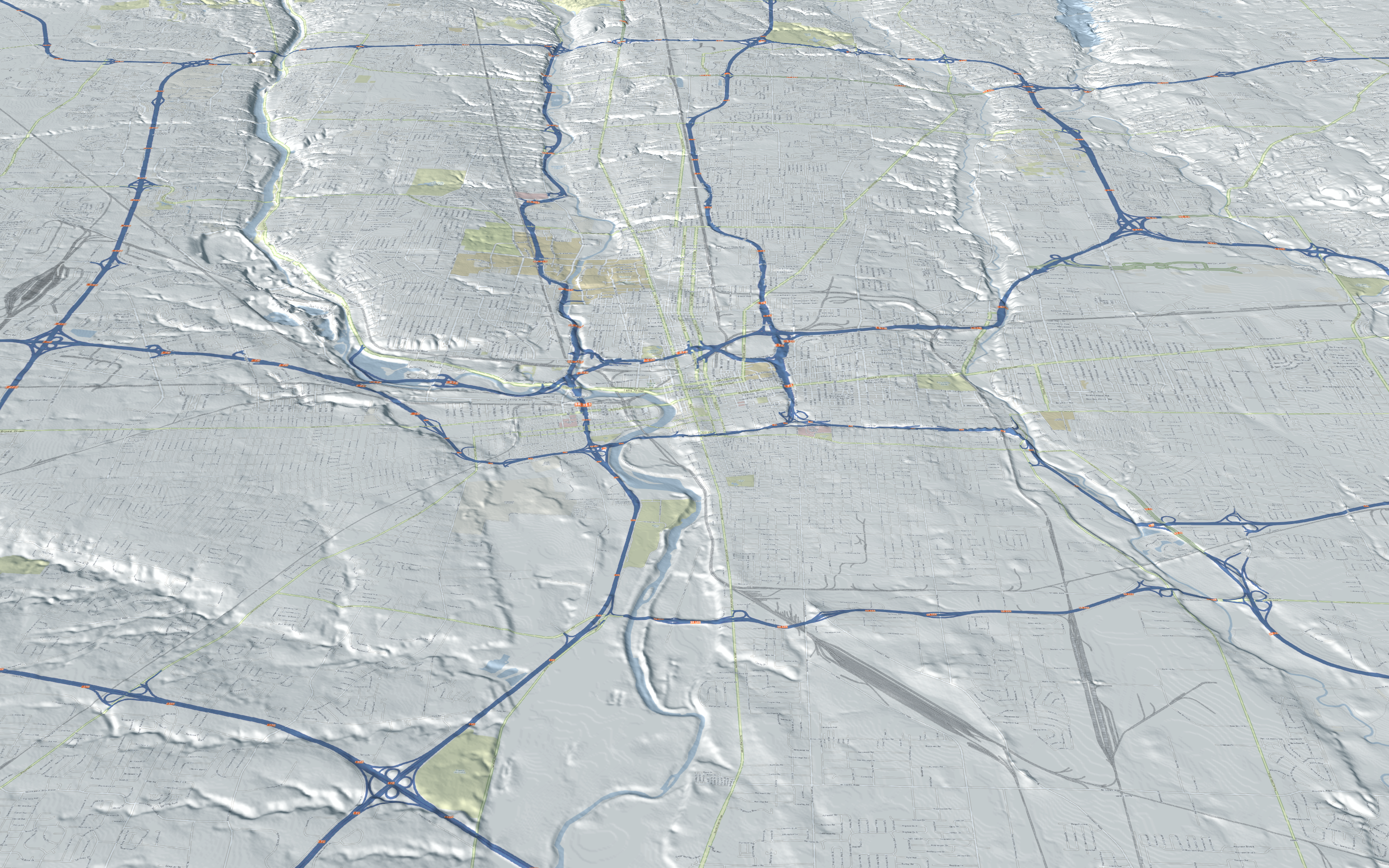
I generated tiles from a mapserver-based WMS that accessed the pgsql data. I'll need to play around a bit with scale to make the text readable in the 3d rendering.
Friday, February 18. 2011
Emphasizing Points
In previous posts we've discussed emphasizing ridgelines, linework, and property boundaries.
Suppose you want to emphasize a point set. Here's a fun way by converting the points into spheres (click for high res version):
The points are raised above ground based on an attribute value. A couple of tricks help them stand out. For one, there's a nice specular reflection to help define it as a 3d object. Also, the spheres cast a shadow that helps highlight their position above ground level.
Here's a close up view (click for high res version):
Wednesday, February 2. 2011
Terrain Morph
We work in a lot of areas with substantial topographic relief. Topography is often the most compelling characteristic of an area and I've found a nice way to emphasize this fact. Instead of looking at a "flat" map or 3d view, what about transitioning between the two? Here's a clip from a video that we're currently working on for Colorado's Staunton State Park:
It's a slick way of focusing your attention on how mountainous the area really is.
(Page 1 of 1, totaling 3 entries)