Ever had problems making lines readable across different background colors? Here's an interesting technique (click on the image to see the whole picture):
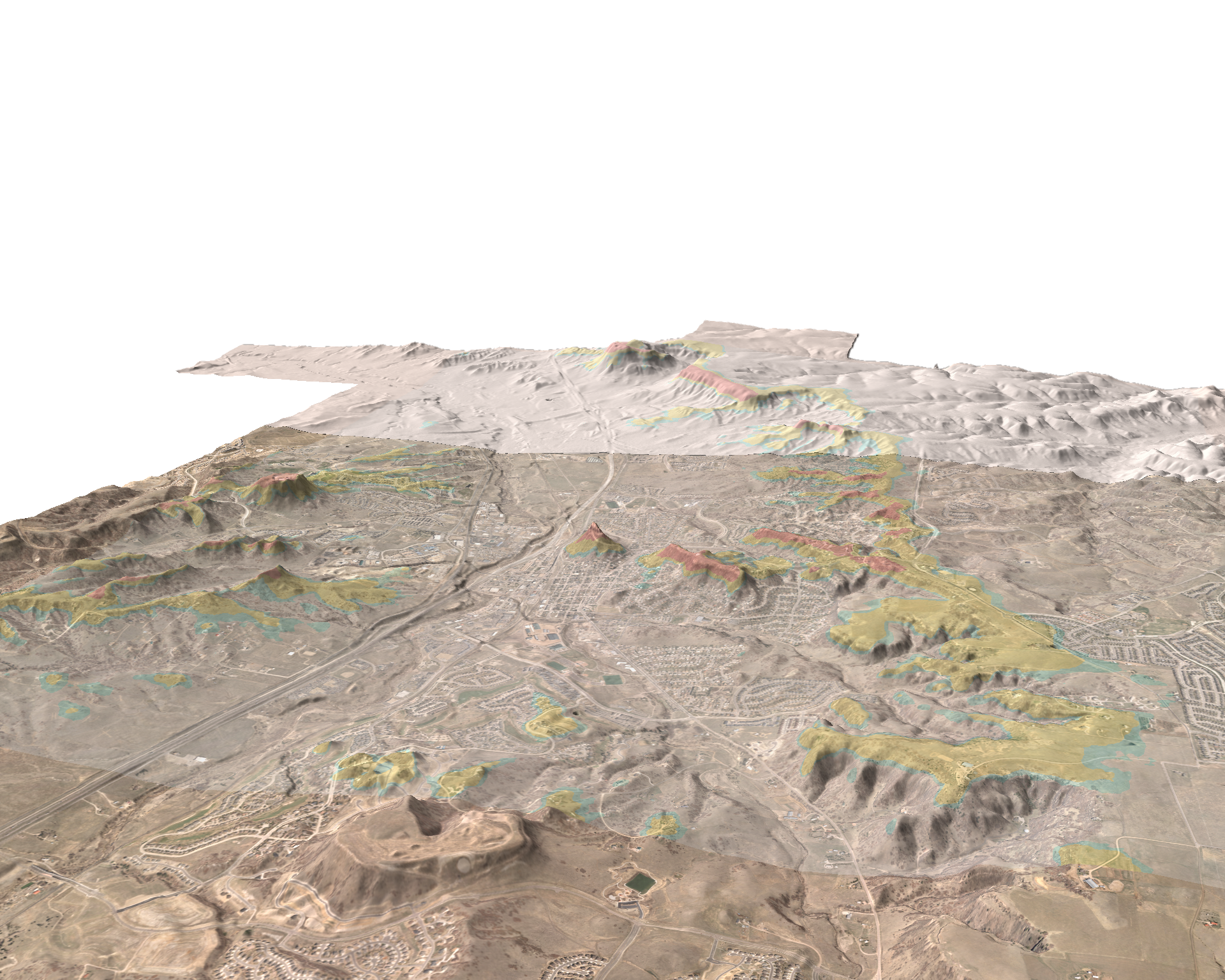
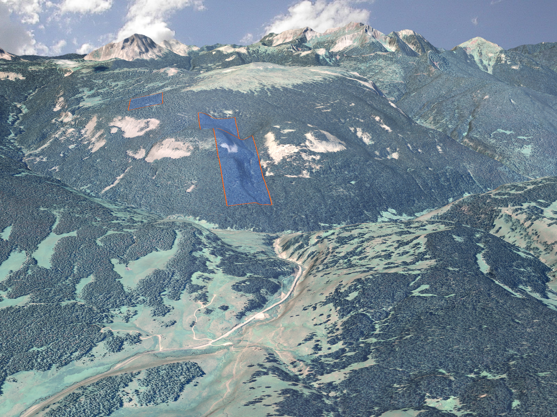
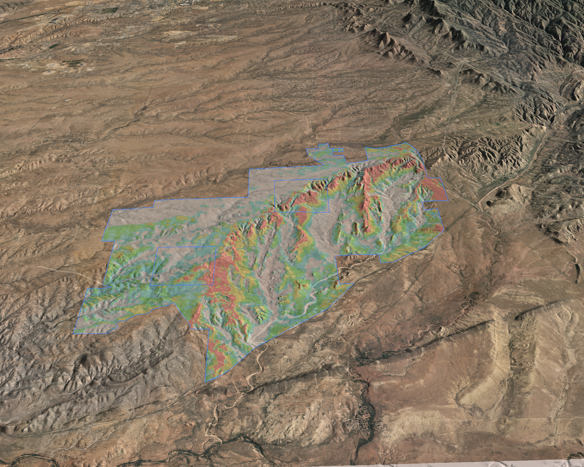
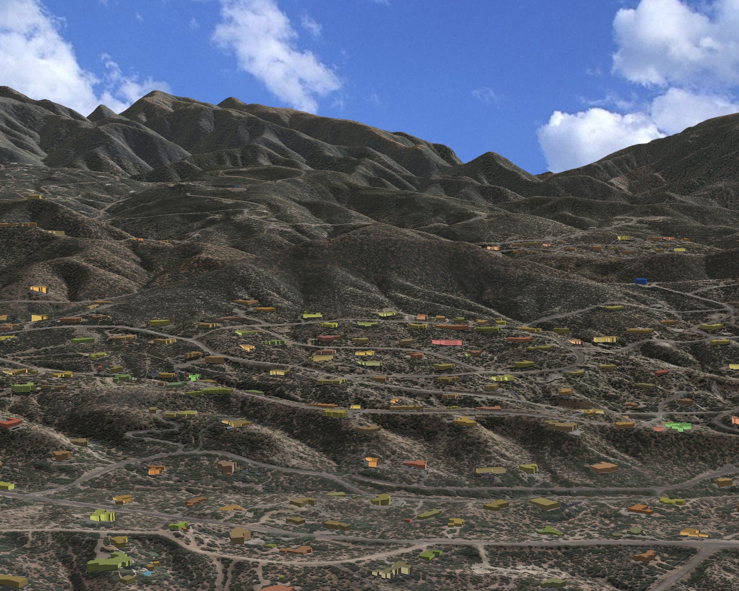
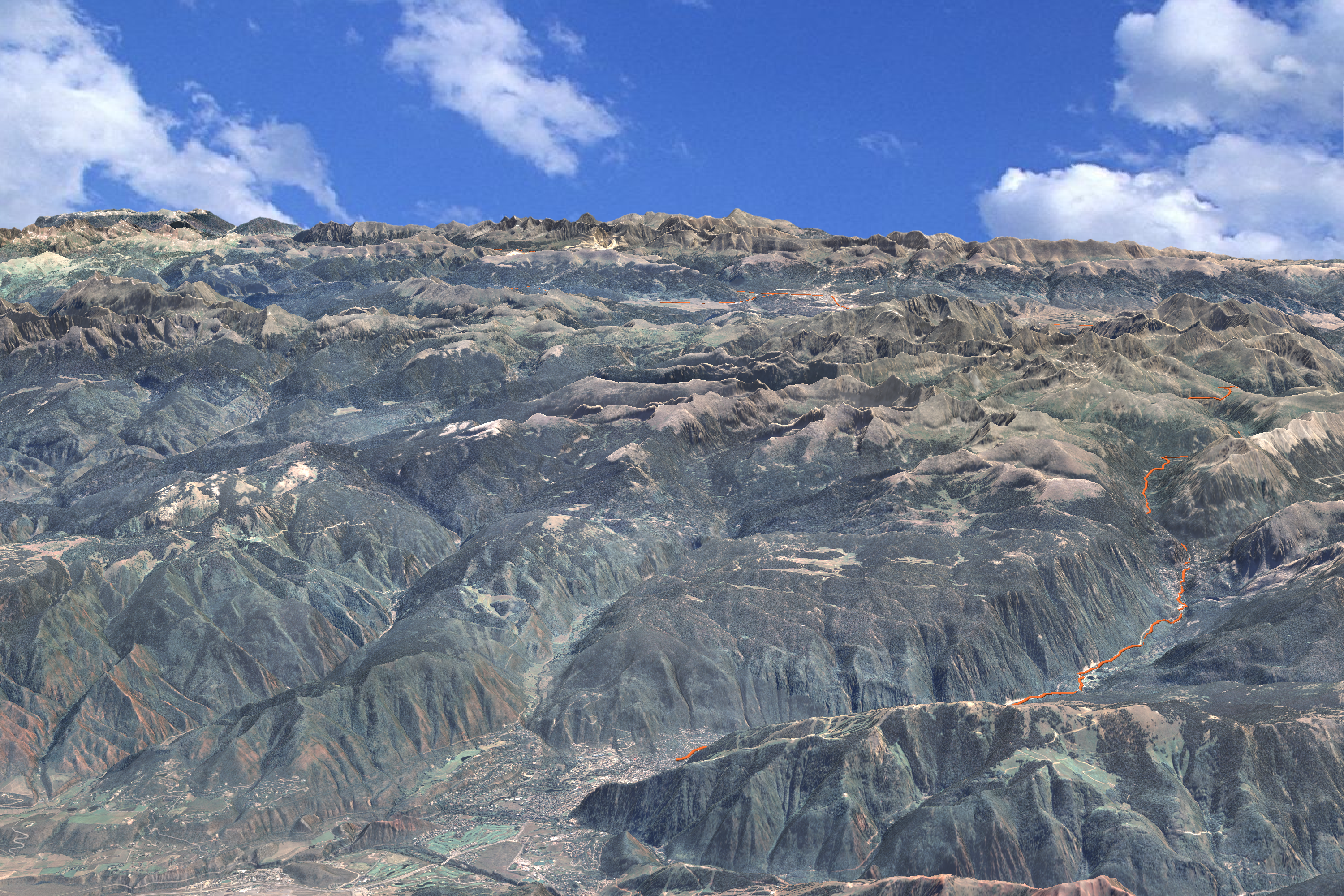
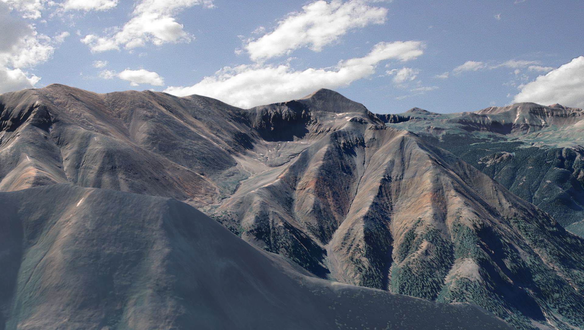
The image above shows a property boundary; the one below shows a social trail network.
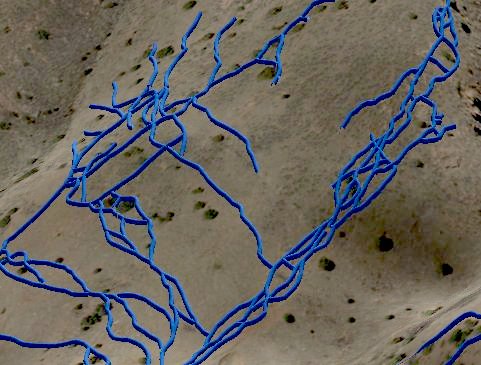
We've "extruded" a circular cross-section along each trail path to create a thin "tube." This tube is a 3d object that is subject to the lighting model and can be assigned a variety of reflective characteristics. It has the additional advantage of diminishing in size with distance, so it provides depth cueing into the scene. We started using this some years back to overcome difficulties with drawing simple 2d lines over varying background colors.
Wednesday, November 3. 2010
Castle Rock Skylines
We were involved in a ridgeline protection project back in 1998 for the Town of Castle Rock, Colorado. This project was an early application of our skyline mapping algorithm, which delineates areas of the landscape where structures would break the skyline. Here's a link to the ordinance that was approved at the end of the project; and here's the final map with legend.
The image below shows a birds eye view of the skyline map.
We've gotten a chance to revisit this work with a new project in the area. It's been very rewarding to find that - with the new tools available 12 years later - that the original mapping is holding up very well. I may be biased, but I think the Town has one of the most defensible ridgeline protection zones around.
Wednesday, October 27. 2010
Missoula, MT Trail map nearing completion
We've been working with Missoula, MT to create a parks and recreation map for the Town. After several rounds of edits, we're almost there. Though there are lots of fun features on the map, my favorite is their mountain backdrop peak finder. The aerial photo clearly shows off their "Letter Mountains", the M on Mount Sentinel (towering over the University of Montana) and the L located on Mount Jumbo. The "peace sign" is just out of view on Water Works Hill.
Wednesday, October 6. 2010
Conserving Land Along the San Juan Skyway
We've done a lot of work in beautiful SW Colorado (for Alpine Loop examples see here, here, here and here).
The area has drop-dead gorgeous scenery, fascinating American Indian and mining history and unbeatable outdoor recreation. Perhaps the greatest jewel in the region is the All-American San Juan Skyway - a scenic and historic byway that traverses an incredible landscape from desert to high mountains.
The Trust For Public Land is a great organization that we've worked with on projects across the western US and they've been working in the Skyway region for many years. They were pivotal in the tremendously successful Red Mountain project and here's one they're working on now, just south of Lizard Head Pass:
With a little luck, these high mountain properties will soon be publicly accessible US Forest Service lands! Congrats to TPL on this and many other successes in the San Juan Skyway area.
Thursday, September 30. 2010
Fun With LiDAR
I stumbled upon this image I created a couple of years ago from some LiDAR data. I was generating a DEM from the LiDAR points - and I guess I was bored. Instead of generating a "point cloud" image, I made a "sphere cloud" image where each (xyz) triple was a sphere center (I don't remember what I used as a radius.) Click on the image below to get the high res version.
It looks like I also did some elevation-based color scheme: blue hues down low with red increasing with altitude. Gives it a cold feeling in the foreground valley and an alpenglow feel in the back. I think the weird color pattern is due to point density.
Wednesday, September 29. 2010
Geo-Animation
We're submitting a proposal for a "pitch" at the Jackson Hole Wildlife Film Festival Symposium coming up October 26-28. Our pitch is for fimmakers to enhance their offerings with the geo-animation service, quickly orienting viewers to places and concepts.
Here's a 3-minute video "Geo-Animation: Animating Places and Processes"
Hope you enjoy..and hope to see you there!
Also submitted at Spike Productions Video Gallery
Here's a 3-minute video "Geo-Animation: Animating Places and Processes"
Hope you enjoy..and hope to see you there!
Also submitted at Spike Productions Video Gallery
Thursday, September 23. 2010
Galisteo Basin Preserve
We've been working for a number of years with the great folks at Commonweal Conservancy on a conservation development project at the 13,500-acre Galisteo Basin Preserve south of Sante Fe, NM. Commonweal's goal is to focus the development in a small portion of the property and preserve approximately 13,000 acres as open space. They've spent a lot of time, money and effort determining the best locations for development and they've made sustainability the driving consideration.
Here's an overview showing the property with a viewshed map overlaid.
From a technical standpoint this has an interesting feature. We've defined a primitive in our 3d program for a "draped image-filled polygon." So rather than trying to build the transparent viewshed map into all the image tiles prior to rendering, it's a simple matter of specifying the image and clipping polygon - something really quick and easy.
Monday, September 20. 2010
Blue Sky Trail
We've recently started a mapping project for Larimer County Natural Areas. Although the end result will be a hard copy open space / trail map, we also did a "trail trace" animation of the popular 13-mile Blue Sky Trail. This trail runs from Highway 34 west of Loveland to the west side of Horsetooth Reservoir.
Larimer County and the City of Fort Collins have done an outstanding job of conserving a variety of natural areas while providing recreational access to residents and visitors.
Friday, September 3. 2010
Defining Ridgelines with Attenuation
We often use 3d visualization to highlight specific landforms like ridgelines. When you view along the ridge axis, you can use lighting that's roughly perpendicular to the ridge axis to highlight. In this way, one side of the ridge is illuminated while the other is shaded.
It's more difficult to bring out a ridge when you're viewing a face straight on (perpendicular to the ridge axis). The whole face is usually either illuminated or shaded and it's hard to distinguish it from background landscape elements.
In the image above, I'd like to highlight the ridge in the center. Right now it blends in with the background terrain and is difficult to see.
Here's where attenuation comes in. I'll model clear air in front of the ridge and haze behind. Here's the result:
Now it really pops!
Thursday, August 26. 2010
Top of the Rockies!
Here's an airplane height view of the well named Top of the Rockies Scenic and Historic Byway.
From Aspen (in the bottom center of the image) the route follows Highway 82 along the upper Roaring Fork to Independence Pass, then down Lake Creek past Twin Lakes to US 24 and the Arkansas River Valley. From there it goes N along US 24 to Leadville at 10,152 ft elevation. The Byway splits into 2 branches at Leadville: one goes NW along US 24 to Minturn; the other follows Highway 91 NE to Copper Mountain.
Be sure to visit before Independence Pass closes for the winter - usually in late October or November.
Friday, August 20. 2010
Silverton to Engineer Pass
This route follows the Animas River NE from Silverton all the way to the top of Engineer Pass:
I did this route 5 or 6 years ago - truly beautiful country! Summer's almost gone folks - better get out there!
Thanks to Spike Productions for the video production work.
I did this route 5 or 6 years ago - truly beautiful country! Summer's almost gone folks - better get out there!
Thanks to Spike Productions for the video production work.
Wednesday, August 11. 2010
Change Parameters - Change Seasons
Most rendering programs (including mine) use "tile pyramids" or sets of image tiles sampled at different levels of detail. This technique allows you to retain high resolution close up with less detail in the background. Altering the appearance of the texture map becomes a nightmare, however, with thousands of tiles at different resolutions. Consequently, I've tried to build some control into the rendering program so that the appearance can be changed at run time.
The image above shows a view of Longs Peak (left) and Mount Meeker (right) using NAIP imagery acquired in the summer season. By adjusting multipliers on the color bands along with the color of the incident "sun" light, I produced this corresponding "winter" scene:
It's not perfect, but it's still pretty compelling.
Monday, July 26. 2010
Colorado's 14ers
Sunshine Peak (14,000 ft - shown below) barely makes the list of fifty-some mountains in Colorado that exceed 14,000 feet in elevation - the "14ers." (See the Longs Peak animation below for another 14er.)
According to the U.S. Forest Service, nearly half a million people visit Colorado's 14ers. Recreation associated with these peaks makes an important economic contribution to a number of mountain towns.
Here are a few other renderings:
Redcloud Peak
Handies Peak
Uncompahgre Peak
Wetterhorn Peak
According to the U.S. Forest Service, nearly half a million people visit Colorado's 14ers. Recreation associated with these peaks makes an important economic contribution to a number of mountain towns.
Here are a few other renderings:
Redcloud Peak
Handies Peak
Uncompahgre Peak
Wetterhorn Peak
Friday, July 16. 2010
Animated Guidebooks
While I'm on the subject of the Alpine Loop, I've been thinking that an animated guidebook - or tour of the area roads and trails - would be sweet. Here's the first route: Corkscrew Pass.
I really like the look and feel of this fly-through and I'm excited to finish up a couple more and get them on the Alpine Loop site. It would be fun to add narration and photos or video footage as well. Maybe in the future...
UPDATE: Here are a couple more:
Lake City to Engineer Pass
Ouray to Cinnamon Pass
Wednesday, July 14. 2010
Alpine Loop
We've been resurrecting material from a project that we did for the BLM 5 or 6 years ago.
The video's 25 minutes, so relax and enjoy.
We've come a long way in film and animation quality, but I think the movie is effective in getting the message across.
The video's 25 minutes, so relax and enjoy.
We've come a long way in film and animation quality, but I think the movie is effective in getting the message across.
« previous page
(Page 4 of 5, totaling 69 entries)
next page »